The last couple of days were the hottest so far this summer in Salt Lake City and much of Utah. The SLC airport hit 106F Sunday and 105F Monday, just below the all-time high of 107F. If you want some relief from the heat, you're in luck!
A weak front moved into Utah last night bringing slightly milder air, and a bit of moisture as well. Satellite imagery this morning shows this clearly, with the main band of limited clouds across the North Central part of the state. My friend in Broomfield, Colorado is likely waking up to sunny skies, lucky him! Here in Utah, there's a mix of mid-high clouds but some sunshine as well.
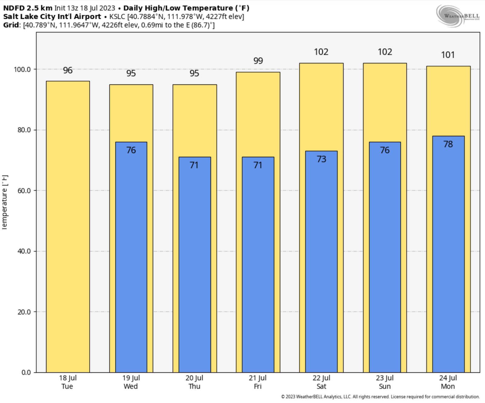
So, let's talk temperatures first. The Salt Lake area can expect high temperatures about 10 degrees cooler than Monday. That's nice! Temperatures will remain moderated the next couple days until this lingering front moves on. Then, yes, a warmup! Here's the National Weather Service forecast highs for Salt Lake City into the weekend.
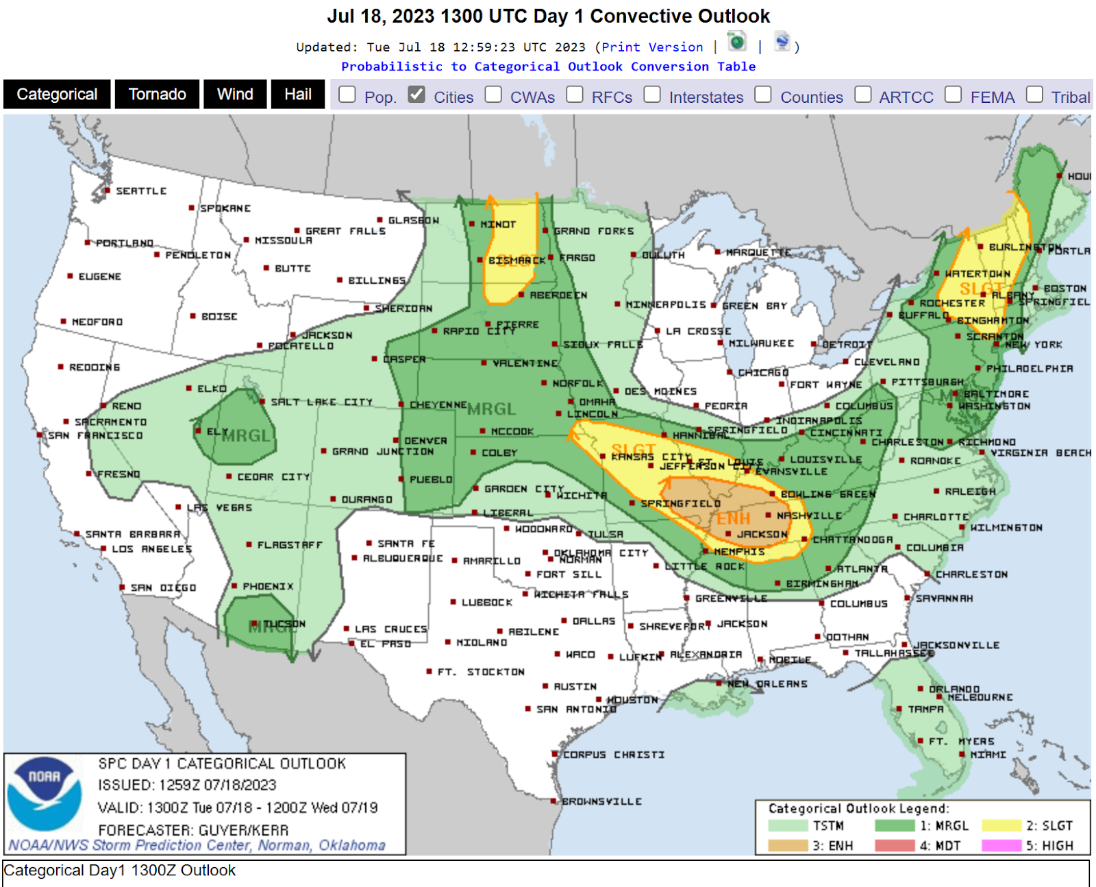
However, moisture will increase aloft across Northern Utah as well, giving a chance of dry thunderstorms initially, then perhaps some precipitation. This is a recipe for strong thunderstorm downburst winds. First off, here's the Storm Prediction Centers convective outlook for today. There's a slight to moderate risk over parts of Utah.
The almost classic inverted-V sounding is evident on the SLC morning sounding which measures temperatures, winds, and humidity (and more) through the atmosphere in the vertical. The dew point and temperatures lines are far apart below 500 mb, which is dry. Thy are closer above 500 mb indicating more moisture. If convection (thunderstorms) deveop, precipitation falling into the dry layer will accelerate downward, resulting in a gusty wind potential. It's not a given, but a potential later today.
While dry outflow winds are likely at the start, eventually the lower levels will moisten up. Dry thunderstorms will transition to wet thunderstorms, especially over central and southern areas where moisture is deeper. The SLC National Service issued this graphic to show where some heavier rainfall could cause flash flooding. This is not a major even but still dangerous for those unaware and engaging in outdoor activities in flood prone areas.


